The Core Components of a Standard Boating Weather Report
A reliable boating weather report provides much more detail than a standard land-based forecast. Land forecasts focus on ambient air temperature, precipitation chances, and mild surface winds, but marine forecasts center around wind velocity, gusts, sustained direction, barometric pressure shifts, and wave dynamics. Understanding how these distinct elements interact is essential for every skipper, whether planning an afternoon cruise across a local reservoir or an overnight coastal passage.
The National Oceanic and Atmospheric Administration (NOAA) issues marine zone forecasts that divide coastal and open waters into distinct geographic sectors. These bulletins establish expected baseline conditions over twelve- to twenty-four-hour windows, with broader outlooks extending across three to five days. Reviewing these regional reports allows you to identify approaching cold fronts, squall lines, and wind shifts that can rapidly alter sea conditions well before bad weather is visible on the horizon.
A proper nautical weather forecast also highlights hazardous weather outlooks, small craft advisories, gale warnings, and special marine statements. These alerts are triggered by specific thresholds in wind speed and sea state, giving mariners clear operational boundaries. Learning to read beyond the headline summary into the specific technical metrics ensures you are never caught unprepared by deteriorating offshore conditions or localized thermal breezes.
Interpreting Wind Velocity, Sustained Direction, and Dangerous Gusts
Wind drives nearly every challenge recreational boaters encounter on open water. In a marine forecast, wind velocity is measured in knots, where one knot equals roughly 1.15 statute miles per hour. Forecasts typically present wind as a sustained average over a two-minute window, paired with a compass direction that indicates where the wind originates. For example, a north wind blows from north to south, pushing water and vessels southward.
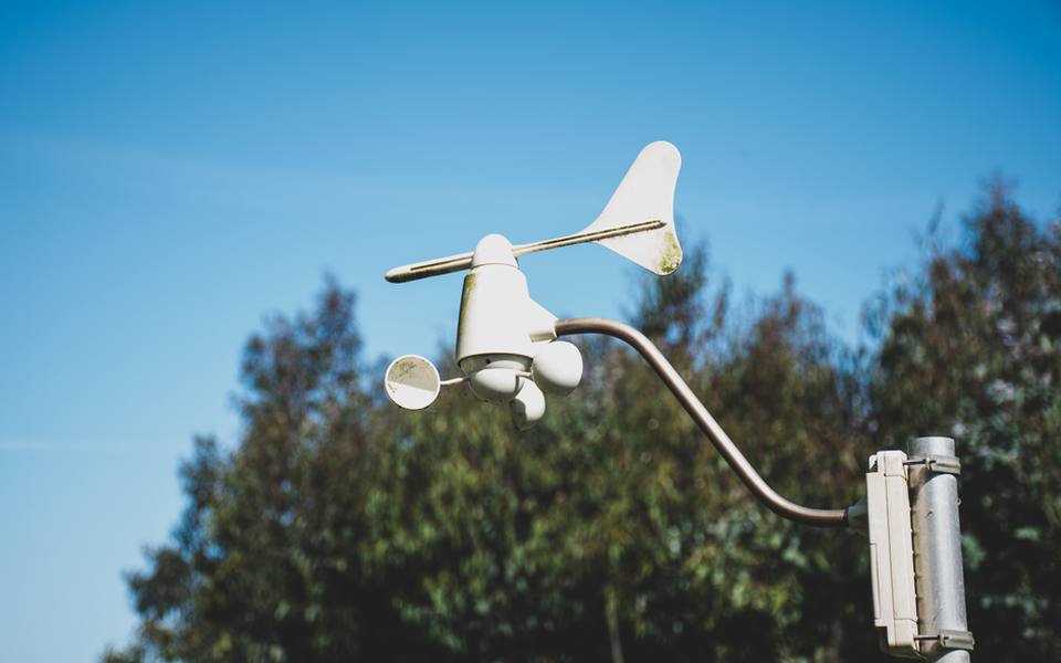
Gust figures are equally critical because they represent brief surges of wind that can exceed sustained speeds by thirty to fifty percent or more. A forecast calling for sustained winds of fifteen knots with gusts up to twenty-five knots signals an environment where handling can suddenly become difficult. Strong gusts create immediate handling issues, heel sailboats sharply, blow lightweight planning hulls off course, and rapidly build steep surface chop across open bays.
Wind direction relative to geography determines what mariners call fetch, which is the uninterrupted distance of open water over which wind blows. A fifteen-knot wind blowing off a nearby shore creates relatively flat water near the beach, whereas the same wind blowing across twenty miles of open bay creates steep, stacked waves. Always assess how surrounding landforms will either shelter your route or amplify chop before casting off from the dock.
Decoding the NOAA Wave Forecast and Significant Wave Height
The primary figure featured in every NOAA wave forecast is significant wave height. Many boaters mistakenly assume this number represents the largest wave they will encounter during their trip, but it actually describes the average height of the highest one-third of all waves observed. Because this metric is an average of the rougher portion of the sea spectrum, individual waves can and often do measure up to twice that published height.
Wave period, which is the time measured in seconds between consecutive wave crests, is just as important as physical wave height. A three-foot sea with an eight-second period feels like a gentle, rolling swell that most vessels handle with ease. In contrast, a three-foot sea with a four-second period creates a short, steep chop that slams against hulls, strains mechanical components, and drenches the cockpit in heavy spray.
When reading an ocean forecast, calculating the wave-steepness ratio provides an immediate safety assessment. If the period in seconds matches or falls below the wave height in feet, conditions are exceptionally steep and uncomfortable. Understanding this relationship helps operators choose appropriate cruising speeds and avoid dangerous bow stuffing when running through tight, closely spaced seas in open coastal waters.
Freshwater Hazards in the Lake Michigan Marine Report
Navigating inland seas presents unique challenges that differ markedly from ocean cruising. A Lake Michigan marine report reflects conditions driven by vast surface area, deep thermal layers, and a lack of salinity that produces short, dense, and punishing wave patterns. Because freshwater is less dense than saltwater, vessels experience reduced buoyancy, causing hulls to sink slightly deeper and react more abruptly to oncoming crests.
Lake Michigan is oriented along a north-south axis spanning roughly three hundred miles, creating massive fetch under prevailing northerly or southerly winds. When strong frontal systems push down from Canada, waves build rapidly over deep northern waters and compress into violent breakers along southern shorelines. Boaters exploring ports near marinas in Michigan must track wave trends closely, as two-foot chop can evolve into six-foot breaking seas within an hour.
Sudden convective storms, commonly referred to as squalls or summer microbursts, are another major risk highlighted in Great Lakes reports. These squall lines frequently cross the lake from west to east during warm summer afternoons, bringing wind gusts exceeding forty knots and zero visibility in driving rain. Monitoring barometric pressure drops and Doppler radar alongside published lake summaries provides the necessary lead time to seek sheltered harbor.
Managing Choppy Basins with the Saginaw Bay Marine Report
Semi-enclosed water bodies require specialized weather analysis due to bathymetry, which is the underwater topography of the basin. The Saginaw Bay marine report regularly warns of rapid wave stacking because the average depth across inner portions of the bay measures less than fifteen feet. When open-lake energy or persistent northeast winds push into this shallow funnel, wave energy compresses against the muddy bottom, creating steep, squared-off waves.
Saginaw Bay is also susceptible to wind-driven water displacement, commonly known as a seiche. Persistent, powerful winds from the southwest push water out of the bay and into the main basin of Lake Huron, temporarily lowering water depths by multiple feet across shallow channels and boat slips. Conversely, a sustained northeast gale pushes lake water deep into the bay, submerging low-lying docks and creating hazardous shoaling over navigation markers.
Boaters running smaller runabouts or fishing rigs must pay close attention to wind shifts across this region. A comfortable morning breeze can turn treacherous by midday if an onshore shift begins opposing localized river discharge. Evaluating shallow-water dynamics before leaving port ensures you have sufficient water beneath your running gear and enough hull clearance to navigate narrow harbor mouths safely.
Evaluating Offshore Swell and Current in Open Ocean Forecasts
A comprehensive ocean weather forecast accounts for long-range energy generated by storm systems thousands of miles away. Unlike localized chop produced by immediate surface winds, ocean swells travel vast distances across open basins as smooth, undulating rollers. While an offshore swell might seem manageable in deep water, it changes character dramatically when it encounters rising coastal continental shelves and shallow inlets.
Ocean forecasts break down sea conditions into distinct swell components, detailing primary swell direction, height, and period alongside localized wind-wave figures. When an incoming ocean swell meets an opposing tidal current at a harbor entrance, waves steepen rapidly, stand up vertically, and break across inlet bars. Launching from a coastal boat launch ramp requires checking both the ocean swell report and the local tide tables to avoid hazardous inlet bar crossings.
Offshore mariners must also evaluate oceanic boundary currents, such as the Gulf Stream along the Eastern Seaboard or the California Current along the Pacific Coast. When strong surface winds blow directly against the heading of a major ocean current, sea heights can double in steepness compared to surrounding waters. Navigators must plot courses that prevent wind-against-current conflicts whenever offshore weather bulletins predict stiff opposing winds.
Subtropical Navigation from Biscayne Bay to Marathon
Boating across South Florida requires interpreting distinct microclimates shaped by shallow flats, barrier islands, and the nearby Florida Straits. A Biscayne Bay boating forecast focuses on shallow-water chop driven by brisk easterly trade winds, which can turn wide, open flats rough for light-tackle skiffs. However, the protective barrier of Key Biscayne and coastal mangrove keys provides substantial shelter compared to the open Atlantic just outside the reef tract.
Further south along the island chain, checking a Marathon boating forecast is crucial for vessels navigating between Florida Bay and the open ocean. Marathon sits in the heart of the Middle Keys, where tidal currents rip forcefully through narrow bridge spans connecting the Gulf of Mexico with the Atlantic Ocean. When strong winter cold fronts drop down with northerly winds, Florida Bay turns into a washing machine of tight, shallow chop, while the southern oceanside reef remains relatively calm.
Subtropical waters also generate intense convective thunderstorms that can appear independently of broad frontal systems. During summer months, moisture building over the Everglades drifts seaward during late afternoon hours, creating intense waterspouts, torrential downpours, and lightning hazards. Operators tying up at Florida marinas should track localized radar animations every hour rather than relying solely on morning text summaries.
Tides, Currents, and the Boating Forecast around Cape Cod
The waters surrounding New England present some of the most dynamic tidal environments anywhere in North America. A boating forecast for Cape Cod must be analyzed through the lens of extreme tidal ranges, powerful underwater currents, and complex geographic topography. Water moving between Cape Cod Bay, Nantucket Sound, and the open Atlantic creates complex rip currents and heavy standing waves across shallow shoals like Monomoy and Pollock Rip.
Dense marine fog is another critical hazard frequently noted in Cape Cod marine outlooks. When warm, moisture-laden air masses drift over cold northern waters, visibility can drop to less than a boat length within minutes. Skippers navigating these waters must ensure their radar systems, sound-signaling devices, and GPS plotters are operational before venturing away from safe harbor, as visual references can vanish without warning.
Seasonal transitions bring powerful nor'easters that drive massive seas straight into exposed eastern anchorages and harbors. Mariners utilizing marinas in Massachusetts must monitor multi-day forecast models closely when autumn low-pressure systems track up the Atlantic coastline. These deep ocean depressions generate powerful storm surges and extended gale-force winds that make coastal navigation extremely hazardous for recreational craft.
Real-Time Tracking Tools: Buoy Stations, Radar, and Marine VHF
While published marine outlooks provide an essential planning baseline, real-time observational data tells you what is happening on the water right now. NOAA's National Data Buoy Center operates hundreds of automated offshore and coastal stations that transmit live wind speeds, peak gusts, air and water temperatures, barometric trends, and exact wave spectrums. Checking buoy observations immediately before departure reveals whether actual conditions are matching or outperforming earlier forecast models.
High-resolution coastal radar tools and marine satellite imagery give mariners visual tracking of advancing squall lines, cold fronts, and localized rain cells. Modern marine electronics allow operators to overlay live weather feeds directly onto their primary navigational charts. Tracking the velocity and direction of squall echoes on screen lets you alter course to skirt the violent core of a storm or calculate exactly how much time remains before conditions deteriorate.
Onboard VHF marine radios remain an indispensable safety tool for continuous weather monitoring. NOAA Weather Radio broadcasts continuously on dedicated VHF frequencies, providing looped updates of local zone forecasts, offshore conditions, and urgent weather warnings. Tuning into these broadcasts while underway ensures you receive immediate audio alerts the moment a small craft advisory or severe thunderstorm warning is issued for your area.
Establishing Safety Thresholds and the Go or No-Go Decision
The final step in interpreting any marine weather forecast is making an objective go or no-go decision at the dock. Every vessel, skipper, and crew has specific operational limits that should never be compromised for scheduling convenience. A sea state that is entirely safe for a forty-foot offshore sportfish can prove catastrophic for an eighteen-foot bowrider carrying inexperienced passengers.
Establish conservative personal limits regarding wind speed, wave height, and visibility before the boating season begins. For most recreational day boaters, sustained winds over fifteen knots or waves exceeding three feet warrant staying in protected waters or remaining tied to the slip. If you plan an overnight itinerary with reservations at transient slips, always maintain a flexible schedule that allows you to delay departure rather than forcing a run through rough seas.
Always build contingency plans that identify alternative sheltered harbors, protected cuts, or bailout points along your planned route. Marine weather forecasting is a science of probabilities, and micro-scale meteorological events can escalate conditions beyond baseline predictions. Respecting the power of wind and water, maintaining vigilant situational awareness, and prioritizing safety ensures every boating excursion concludes peacefully back at port.
Published 2026-09-21 · reviewed with each rebuild, last September 2026.
Find marinas near you
The directory lists 7,143 marinas by state and city — pick your state or use the “Near me” button in the header.
More guides
-
 Safety
Boat Fire Extinguisher Inspection: Schedule, Checklist, and Costs
-
 Money
MoneyBoat Club Membership Costs: Initiation Fees, Monthly Dues, and Ownership Comparison
-
 Storage
Boat Winterization and Storage: Costs, Checklist, and Shrink Wrapping Guide
-
 Storage
Boat Slips and Docking Fees: How Much Does It Cost to Keep a Boat in the Water?
-
 Owning
Essential Nautical Terms and Practical Boating Knowledge: From the Helm to Harbor Life
-
 Owning
A Practical Guide to Boat Mooring: Buoys, Lines, and Technique
-
 Safety
Essential Boat Safety Gear, Marine Electronics, and Equipment Guide
-
 Service
Outboard Engine Service and Rebuild Costs: What Boat Owners Should Expect to Pay
-
 Safety
Marine Weather Forecasts and Warnings: Reading NOAA Reports and Coastal Maps
-
 Safety
Boating Safety Certification and Licensing: State Requirements and Exam Prep
-
 Service
Saltwater and Freshwater Fishing Charters: Choosing Inshore, Offshore, and Deep Sea Trips
-
 Owning
Bareboat Yacht Charters: How to Rent, Qualifications, and Cruising Preparation
-
 Buying
Pontoon & Tritoon Boats: Buying, Renting, Models, and Pricing Guide
-
 Owning
Holiday Boat Parades and Coastal Festivals: Viewing Guide and Schedules
-
 Buying
A Complete Guide to Buying Used Boats: Valuations, Inspections, and Registration
-
 Owning
Waterfront Dining and Dockside Restaurants: Boater's Guide to Dock and Dine
-
 Owning
Dockside Bait Systems, Live Bait Sourcing, and Fish Cleaning Station Setup
-
 Safety
Marine Fire Safety Inspection and Extinguisher Maintenance
-
 Storage
Complete Guide to Boat Winterization, Shrink Wrapping, and Storage Covers
-
 Buying
Electric Boat Motors and Trolling Systems: The Practical Conversion Guide
-
 Owning
A Practical Guide to Public Boat Launches, Kayak Ramps, and Water Access
-
 Owning
Marine Lithium Batteries vs AGM: Setup, Charging, and Performance
-
Service
Boat Fiberglass & Gelcoat Repair Guide: Fixing Cracks, Blisters & Scratches
-
Service
Marine Fuel Tank Cleaning and Rust Removal Guide
-
Safety
USCG Captain's License Guide: OUPV 6-Pack Requirements and Renewal
-
Buying
Boat Dinghies and Inflatables Guide: Types, Motors, and Selection
-
Service
Boat Towing Services and Marine Assistance Memberships Explained
-
Owning
Boat Lettering, Registration Numbers, and Custom Vinyl Decals
-
Service
Outboard Motor and Lower Unit Maintenance, Repair, and Marine Diesel Guide
-
Buying
Shallow Water Anchor Systems: Power-Pole vs. Minn Kota Talon & Raptor
-
 Service
Complete Guide to Marine Bottom Paint and Antifouling Application
-
Owning
Cruising America's Great Loop: Route Planning, Boat Choice, and Cruising Resources
-
Service
Boat and Fishing Charters: Complete Guide to Styles, Rates, and Booking
-
Buying
Personal Watercraft and Jet Ski Guide: Models, Rentals, and Buying
-
 Owning
Marine Supply Stores and Chandleries: Outfitting Your Boat
-
Safety
USCG Boat Registration, Boater Education, and Navigational Safety Rules
-
Owning
Marine Lithium Batteries, Solar Panel Systems, and Trickle Charging Guide
-
Service
Boat Trailer Maintenance: Bearings, Replacement Kits, and Towing Prep
-
Safety
Marine VHF Radio Frequencies, Channels, and Electronics Setup
-
 Service
Complete Boat Hull Maintenance Guide: Washing, Acid Cleaners, Gelcoat Repair, and Antifouling Paint
-
Service
Fixing Inflatable Boat Leaks and Replacing Worn Bimini Top Canvas
-
Owning
Buoy Mooring Setup, Dock Lines, Cleat Hitch Knots, and Anchor Pins
-
 Owning
Boat Trim Tabs Guide: Lenco, Zipwake, Bennett, and Electric vs Hydraulic
-
Owning
Upgrading Boat Swim Platforms, Boarding Ladders, and Marine Vinyl Seating
-
Owning
Best Gifts for Boaters, Practical Marine Accessories, and Kayak Storage Racks